Pages

Wednesday, October 20, 2021

South Fork of the Holston (VA) and Watauga (TN) River Trout Fly Fishing

I wanted to head back to the Pisgah National Forest to try to get in some sunny day hikes that eluded me a few years back and on the way there hit some new trout streams. I always get excited when the mountains start to loom in the distance.
For the first leg to the South Fork of the Holston River, I was hoping to join my friend Chris, but a death in the family threw a wrench in the plans and I had to fish it solo. Chris graciously provided some excellent maps of the river which guided me to key access points.
There is a dam in the river and I decided to enter just below the dam and work my way upstream.  Just follow the gravel path to the stream.

It's pretty inconspicuous on the map so I've labelled the location of the dam.  This is what that portion of the stream looks like.
In the drizzle, I caught a beautiful little rainbow on a parachute Adams; it still had its parr marks.

As I walked upstream, I saw many large crayfish in the water.
One even attacked a small brookie I caught as I released it still stunned from the catch and release. 
I shooed him away and the brookie swam off unharmed.  I did tie on a CK crayfish pattern and plumbed the depths of the dam's plunge pools, but to no avail.  Upstream I went.  There's beautiful water above the dam; it looked like this:


Nice pools and long runs.  With the rain, the water was moving pretty fast, so I switched to a small stimulator, frequently interrupting my casting to blow on the fly and apply floatant to keep it bouyant.  That combination proved successful and I landed both a gorgeous rainbow...
... and a brown, completing the trout species hat trick.

It was getting dark so I headed back to the car, but on the way, a small feeder stream crossed the trail and I looked for another brookie.  I saw a tiny pool, but it looked promising.  On the first cast, a fish rose and took the stimmie - but instead of a brookie, I was shocked to see that it was a brown in that small trickle of a stream.  
Back at the car, I stripped down in the dark, and intended to make quick time headed to my campsite at Hurricane Campground.  However, without any cell service, my phone's navigation would not work and I had forgotten to download the map before losing services.  I lurched around in the dark for nearly an hour before I found service and could load the nav on my phone.  In the dark, I proceeded gingerly along the winding, dirt, single track road along Comers Creek.  I was praying for no oncoming traffic, downed trees or any other need to turn around since there was no visible shoulder, just a steep drop off into the gulch and river below.  

If it hadn't been pitch black, I would have seen this sign to greet me.
Not having a reservation, I found a site that looked dry and presentable (I chose site 10) and paid my fee at the kiosk, set up the tent, and went directly to bed. 
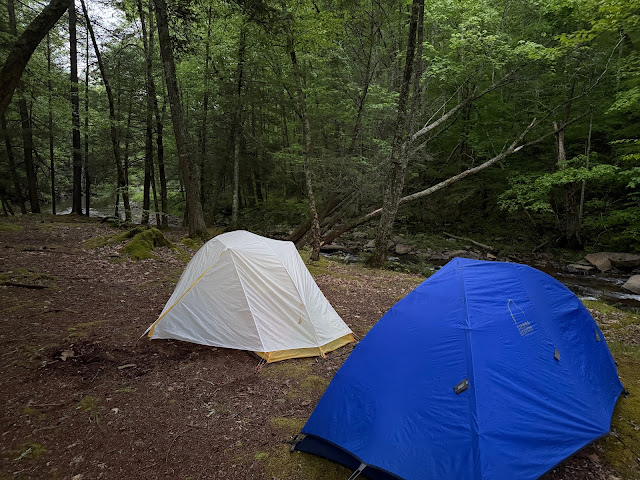
I got up the next morning and boiled water for coffee and oatmeal for breakfast as I took the tent down.  
The fly and footprint were wet, but the main tent was dry so I packed it in the car so I could let the wind dry the wet parts on my way to TN.  I got it all in the car before it started raining again.

I had to follow Comers Creek back out and in the daytime I noticed that there were pull-outs and even some nice looking campsites along the river that I could have used for free - next time!  I stopped at one nice looking section of Comers Creek and threw the same small stimulator in some promising water and instead of landing a brookie like I thought, a brown took the fly.
As I emerged from the dirt section of Comers Creek Road, I came across this verdant farm property as the storm clouds were giving way to the morning sun.  Pretty...
Back in the world of wifi, I was able to catch up with my buddy Paul from Bristol, TN and we made plans to rendezvous in Johnson City for lunch before heading to the Wautuga River.

Paul and I met up, had some nice a la carte tacos, and then made our way to the Watauga River Bluffs State Natural Area.
We had a short hike to the river that was pretty easy and as soon as we hit the water, we could see fish rising.  It didn't take us long to rig up, wade out and start casting.  In the river, there were these rock ledges closer to shore; further out the river got consistently deeper.  It was a beautiful set up.
At first, I couldn't tell what the fish were rising too, so I put on a small, size 18 sulphur.  Even though several fish were rising within range, I couldn't get them to take the fly.  I switched to a female, egg-laying Adams, with the yellow egg sac and that seemed to do the trick and the first rainbow came to hand.

I moved among the rock ledges targeting and catching rising fish, but I was drawn to this one rising consistently near my feet, seemingly unperterbed by my presence.  IT was so close I couldn't even cast, so I just reached over and dappled the fly on the water and he rose and swallowed it.  He ran for the next county, but I brought him to the net eventually.  Turned out to be my nicest fish of the day!
I hopscotched with Paul, moving upstream, but being mindful of the dam release that was supposed to bring rising waters to us at around 5pm.  Out of an abundance of caution, we stopped at 5pm having had a wonderful afternoon on the Watauga.
I bid farewell to Paul and continued on to my evening's campsite at Roan Mountain State Park.  I laid out the rain fly and opened the car windows for a wind-dry, and stopped midway to put the dry fly away and dry the footprint - perfect!  It took me about an hour so, as typical, I pulled in and searched for my reserved campsite in the dark.  I set up the tent and sparked up the MSR stove to make dinner.
While the dinner was steeping, I hit the head and found out that not only was the bathroom heated, but that it had hot showers!  After dinner, I took full advantage of that amenity!  Just as I settled down to sleep, it started raining again.

I woke up the next morning with no rain and quickly made breakfast as I deconstructed the tent.  Once again, I separated the wet footprint and fly from the rest of the dry tent.  I made it all back into the car before it started raining again.  I drove to the Roan Mountain State Park camp store, hoping I could get a weather report to determine if a Pisgah hike was reasonable.

I think I was their first customer and WAS able to get a weather report and it seemed promising.  Before leaving the park I inquired about hiking to the balds nearby and since it was a short hike, I decided to go for it.  On the climb up to Carvers Gap, the sun was out and the valley below looked dry and gorgeous!
Unfortunately, when I got all the way up to Carvers Gap, I was enveloped in clouds and mist.
Since I was already there, I decided to do the hike to get some warm up miles on the legs and prayed for some sky clearing.  Here's how the trail to Round Bald and Jane's Bald starts out.
It was only a little over a mile to Round Bald and the sections through the trees were very scenic.

Not really much to see at Round Bald.  Too bad, because it's supposed to have a 365 panorama of the surrounding mountains.
If I'm ever back in the area, I'll give it another try since it and Jane's Bald are such an easy short hike from the Carvers Gap parking lot.

Back at the car, I hightailed it towards the Art Loeb III/Black Balsam Knob trailhead with much anticipation.  I stoped at a Mickey Ds and switched the fly for the footprint using my widow drying technique. and made it to the trailhead shrouded in clouds and mist.  Deja vu all over again! 

The overnight forecast was for a few short periods of rain overnight with accumulations of about 0.1 inches of rain each - good weather for the Pisgah!  I hit the trail about 2pm in long pants, a wool t-shirt and raincoat.
I climbed steadily to the Art Loeb plaque on Black Balsam Knob and, like last time, the views were denied me. 
Nevertheless, I was feeling good and energized hiking solo.  As the Ranger Station reported, the trail had suffered from Hurricane Fred and the trail was washed out in places making the foot placement a little treacherous.  Looking down, I also became aware that some side toe rubber was coming loose, exposing the tread below.  A bad sign.  I prayed it would hold together until my exit the next day but started thinking about mitigation measures.
Even in the overcast skies and misty conditions, the vegetation was diverse and beautiful.  The blueberry bushes were putting on a show - some still had berries, but I did not partake.
The berries did make me think about bears.  You know how they say that bears smell like wet dog?  I was smelling a lot of wet dog smells.  I think finally though I was resigned to the fact that my wool shirt + sweat = wet dog smell.  I continued onward...
Before too long, I crested the knob that is Tennent Mountain.
Again, the view from the plaque was frustratingly familiar.  At 6,040 feet, no expansive view of the surrounding mountains or the valleys below.  Just mist, clouds and overcast skies.  
At least it wasn't raining like the last time we attempted to penetrate into the Shining Rock Wilderness.  I pressed on...
The trail gullies were deep, so I was constantly watching my footfalls.  But every once in the while I'd lift my head and take in the foggy view.  It was still gorgeous.  Bye and bye, I got to Ivestor Gap.
A spider web of trail converge and depart from here.  This trail leads to Grassy Cove Ridge, but that was not my trail to take. 
I was wayfinding solo and reveling in the in the self reliance.  I pointed myself towards Flower Knob and ascended into the Shining Rock Wilderness.   
Explosions of colorful blueberries lined my way....

Eventually, I made it to Shining Rock Gap.  This was the turnaround point on our last hike into this wilderness.  I has happy to push on into new territory.  "Hold on boots" I repeated over and over in my head.
Not long after the gap, the trail lead me into an outcropping of white rock, some sort of quartz I'm guessing.  I stopped to take in the striking juxtaposition of the quartz, dark woods, and forest floor. 

I climbed up on top of the monolith, but even after this feat was still not rewarded with any view and gingerly made my way back down. 
I kept pushing on deeper into the Shining Rock Wilderness.  I told myself that I would keep hiking until near darkness and then find a place to camp for the night.  I kept on towards Stairs Mountain.  Unfortunately, the trail came to a split without any trail marker.  I assessed the trail trying to discern which was the "main" trail but in the end just picked the right one.  I continued on for about a half an hour as the trail veered to the east, and got smaller, narrower, and was going downhill.  

It didn't feel right and there were no good camping sites, so I decided the safe thing to do was to backtrack to the Shining Rock where there were some good sites in the trees.

I found the site I had in mind, set up the tent, and started boiling water for dinner.  
I had made one mistake on my hike - forgetting a water bottle, so I had been hoarding water to make sure I had enough to get back out the next day.  I'm usually a camel so this wasn't too hard.  I made and ate dinner as the wind picked up and a slight drizzle started.  

I packed my required bear canister and located a memorable site 100 yards from the campsite on the other side of the trail.  While grabbing the bark of a tree, I felt a little squish.  As I shined my headlamp on the bark, I found this salamander climbing up the tree.  Scanning up and down, I found another hot on his heals.  Taking refuge from the flooded ground?
Once the bear canister was in place, I returned to the campsite.  Checking my phone, I had 3 bars, so I called Kathi to tell her I was alive and safe.  She started telling my about this guy who was wanted for murdering his girlfriend and was thought to be on the loose in NC.  As she was saying this, on speaker (I thought I was totally alone), two headlamps shined into my camp!

I told her I would call her back after I dealt with this intrusion, but the headlands turned back down the trail.  I called Kathi back and she was freaking out!  I reassured her and then, as the rain picked up, crawled into the tent.

The last time I was int he Pisgah National Forest, the daily, steady rain exposed a fly weakness in my group tent - forcing us to pitch it underneath our pavilion's roof (after taking a lot of ribbing).  On this night, the Pisgah dealt another death-blow.  As the rain and wind became more intense, water started leaking through my fly, collecting on the tent mesh, and then dripping on my down bag and in my face.  What to do.  I was perturbed, and that kept me awake for a while, but finally, I just pulled my raincoat over my head to divert the drips of water away from my face and eventually got some sleep.  Throughout the night, the rain and wind got pretty intense.  There was no let up and it really poured - contrary to the hike-deciding weather report.

I got up  the next morning, retrieved the bear canister, changed into a dry wool long-sleeved shirt and fresh socks, packed up my soaked tent, and got the hell out of there.  I knew I was gonna get soaked so my plan was just to keep moving to stay warm.  I must say, the wool shirt was key.  No fire, to use of water, I just had a dry energy bar and hit the trail.  I'd have a sip of water at key waypoints - Shining Rock Gap, Ivestor Gap, car.  

I made haste, watching my footsteps as the sole of my right boot continued to deteriorate.  Hang on buddy!  The rain was slow, but steady but the trail was still beautiful.  I embraced the wetness and my  wet-dog aroma.  

I backtracked to Grassy Cove Top but made a critical error at one fo the unmarked junctures.  I zigged when I should have zagged, and the trail got more incised, more eroded, and flat out dangerous.  I was cursing the Pisgah trial maintenance crews, the National Park, Hurricane Fred - it kept me focused and warm as the miles ticked away.   
When I finally picked my way to Ivestor Gap, and saw the passed this sign, I turned around to read it and rsealized my navigation error.  
The curses against trail maintenance crews were re-routed towards trail marking crews.  At this point, I was thoroughly soaked and I just wanted to get back to the car to strip and put on dry warm clothes.  I had no need to hike back up Tennent Mountain and then up to Black Balsam Knob at 6,214 feet.  So I took the easy way out and opted for the wide, graded, multi-use horse/bike/hiking trail back to the trailhead.  As anticipated, the hiking was easy, and I got to cross many ephemeral streams created by water coursing off the mountaintop.  I made quick time on the horse trail, talked to a mountain biker heading up (hat's off!), and made my way back to the car.

I tried to remind myself to take a selfie to document my soaked condition, but the desire to get dry overwhelmed all other thoughts and reason and soon I was in the car.  It was only Wednesday and I didn't have to be home until Friday, but since the hiking boots were failing, the tent fly was non-functional, and the tent and my sleeping bag were wet, I didn't relish another night or two of camping.  I made the command decision to drive the 7 hours home to rally and unpack and dry all the wet gear. 

On the way home, I got a call from my friend Will who was jonesing to go fly fishing.  So a Plan B was hatched.  I would go home, tend to the gear, get a good night's sleep and then hit the road again to camp out in the Shenandoah and fish one of its streams.

I left Hampton Roads around noon, and I rendezvoused with Will outside Richmond around 3PM.  I oogled at all the trappings in REI to pass the time before Will's arrival.  Once on the road, we scuttled our plan to fish Thursday evening and instead opted for an enjoyable meal and a beer at Blue Mountain Brewery.  Good choice!  We camped at Hone Quarry campground, and even coaxed out a decent fire from some locally purchase, but unseasoned wood, wet kindling, a home-made firestarter and some pages from Blue Ridge Outdoors magazine.  The crackle of the fire, a cold beer, and the rush of the nearby stream lulled us to sleep.

We got up the next day and made breakfast as we broke down camp.  We navigated to the North River, above the dam, and Will counted river crossings to find the best water.  I fished upstream and Will concentrated on a section below.  This is some pretty water!
I threw the same stimulator, and started catching brookies straight off.  It was fun, easy fishing and that was nice, because we only had the morning to take advantage of.  The brookies were beautiful!
Even better in close-up!  Liquid jewels...
At around noon, we quit, hoped in the car and pointed east.  We called our good friends at Mossy Creek Fly Fishing and gave them a report and continued on to Richmond and then me home in Virginia Beach.  

It was a long week with some spectacular fishing in VA and TN, and an overnight drencher of a hike, championed with ample doses of resilience.  Still, I was grateful to spend it in the outdoors.  Picked up some new hiking boots at REI and I'm ready to go!

Thanks to all the friends that provided resources or company to fuel my adventure - Chris, Paul, Will.  I value your freindship.

Peace. 


Sunday, August 15, 2021

Everglades Paddle-palooza 2021

Fishing the Everglades backcountry has been a dream for a while.  I kept reading and hearing stories of loads of baby tarpon, whispers of the cornucopia of fish in the mud lakes, and I'm a sucker for a National Park, so the die was cast.  As part of our series of epic DIY trips my co-adventurer David and I were supposed to do this trip five or six years ago, but then the Zika virus was threatening women having children and David's wife was pregnant so we bailed and went to Fernie, BC for bull trout and cutthroats instead (also an epic trip! - see earlier blog posts).  But now we were back on our FL kick.  

I left early on a Friday morning since I had some tasks to accomplish on the way to pick up David at the Miami Airport. I took my friend Tom's advice and took the back roads through the cotton fields and country lanes of Virginia for a relaxing drive on my way to Myrtle Beach.  I was fulfilling my father's wishes to have a portion of his ashes deposited in the ocean setting where he and my mother spent so much time and that they cherished so much.  15 minutes out I called Mom and asked her if she wanted to FaceTime as I was depositing Pop's ashes. She said yes. So I parked the car at the condo they used to rent religiously for a few months each winter and hustled my way down the beach access dialing her number as I went. I got her on FaceTime and she was able to watch as Pop's ashes mixed with the surf and the sea and made their way out into the ocean that he loved so much. 

Got back in the car and took the slow road to Charleston and then finally jumped back on the highway and made my way to route I95 and pointed the "Canoe-baru"south. 

The miles ticked away as I rushed through South Carolina then through Georgia and into Florida. After crossing the border, I called my buddy Jimmy to make sure he wasn’t still at his condo in St. Augustine - a potential stop over spot. He was still vacationing in the Keys but offered to let me stay at the condo and gave me instructions to turn on the water and unlock the lock box for entry. I found the condo unit in the dark, parked the car with the canoe on top and fumbled with the lock box until I got it open and opened the door. I watched a little TV to relax and had a bowl of Cheerios, washed the dishes and went to bed.

I got up early the next morning and drove to the Orlando airport to pick up Kathi. Once I scooped her up we made our way to the grand Bohemian Hotel where the valet parked the Canoebaru on the street in a prominent location. The wedding was fun but I’m glad we were vaccinated because otherwise it would’ve been a super spreader event as no one wore masks the liquor was flowing and people were friendly. After the reception, Kathi and I went to bed while the young kids started their after-party at the pool and ended it God knows where! We had a nice but hurried brunch at the hotel with the Virginia Beach gang before hustling Kathi off to the airport. After dropping her off, I pointed to car south again towards Miami. I drove through two or three thunderstorms on the 4 hour drive and got a cheap hotel near the airport for the night. What a great decision! I was bushed! I went out for a quick bite, watched some Star Wars and then went to bed. 

Woke up Monday morning early, made a quick trip to Walmart to get Thermacell refills for David, then went to a Cuban bakery and got great coffee and the Cuban version of a bacon, egg and cheese sandwich which was very good.  Then made my way to the Fly Shop of Miami and waited in the camp chair until the store opened at 10. The shop had very little equipment in it but I did get good intel on where to catch peacock bass not 10 minutes from the shop. I was dispatched to A.D Barnes Park where I spent several hours spooking the iguanas...
and sight-casting to peacock bass.
I read in an article on fishing the Miami Airport lakes that they liked a Murdich Minnow in golden shiner colors so I did my best to follow those instructions.  They took both the colored and all white/pearl versions - stripped fast!  I caught two beautiful fish!  
The first was released back into the Coral Gables Canal while the second was released into the bag of a local subsistence angler.  I gladly traded the fish for a snapshot.  
At one point, I had hooked my fly in a bush with reddish berries and, I won't lie, spent more than a few minutes googling information and hoping it wasn’t poisonwood! What a way to start a backcountry vacation!  I grabbed a quickie lunch and then found a place to park close to the airport and waited for David‘s arrival from Wisconsin at Miami Airport.  

I picked up David at the airport and we were off to Chokoloskee.  We made our way to the Tamiami Trail and headed west, taking in the massive waterworks that have disrupted the Everglades' flow with devastating impacts to the "river of grass".  Here's an example of one of the pump stations that moves the water to the west through the Tamiami canal.
Looking at the river of grass to the south...
Having seen anglers all along the Tamiami Canal, we were curious about the fishing opportunities so we stopped at one spot where we could easily pull off.  the fish in the canal were very active on the surface.  David got lots of follows, but it was hard to get takes on the mystery fish.  After trying a couple of flies, I got lucky with a purple and black fly I had tied for fish in murky water in the Chesapeake Bay.    
It tricked this little Oscar, an exotic Brazilian fish used in the aquarium trade, but released (by whom?) into the canal.  Love the red "eye" spot on the tail! 


Chokoloskee!
Verily, we made our way to Chokoloskee, scoped out our campsite at the Cholokoloskee Island Park (highly recommended), and then back-tracked the 10 minutes to Everglades City for some dinner and a brew at the Camellia Street Grill.

We started outside at a table overlooking the water, but the bugs drove us inside.  We got a variety of fish tacos and some excellent cucumber salad as a side.  We closed down the place as we discussed the coming day's guide trip, rod setups, etc.  Back at camp, it didn't take long to fall asleep.

Tuesday, Guide Day:  We got up early as we were instructed to meet our guide in Everglades City at 6:45.  As the water boiled for oatmeal and coffee, we strung up the rods and prepped for a day on the water.  Anxious to fish, we were half an hour early.  We met our guide, he instructed us to wipe our feet before stepping aboard 😒 and we motored to the fishing grounds.  
Unfortunately, the story from here gets a little disappointing.  The guide, "he who shall not be named", right out of the gate was, in my opinion, critical and derogatory, which put a pall on the rest of the day.  The point of hiring a guide in unfamiliar waters is to learn and gain knowledge and experience, not to be criticized for that lack of knowledge or experience.  I won't belabor this point or our experience, but it was not productive in my view.  We did see a large tarpon in the morning, but never got a legit shot.  
Later, between David and I, we caught one large red drum and two snook sight fishing on a flat as the tide rose.  


After lunch, we went way south into the backcountry in search of baby tarpon.  We found fish chasing bait, but couldn't crack the code of the correct fly to pitch up into the mangroves so the afternoon was a bust.  

We did see a rare sawfish, or carpenter shark (actually in the ray family), so that was cool!
We returned to the docks, paid our guide plus tip (we're not dicks) and bid adieu.  The guide didn't offer any insights into places to go with our canoe as he said he would.  Not having spoken among ourselves, David and I recapped our experiences on the way to the bait and tackle store and agreed it was bad.  We bought some small hooks to tie up facsimiles of the flies we used that day (since the flies the guide told me in advance to tie, he never used) and headed for a cold beer and some grub at the Island Cafe in Everglades City.  We had some good eats and then made our way back to our Chokoloskee Island Marina campsite to tie up some flies.

The marina had a waterfront activity room with a full kitchen and tables and chairs, so we took up one and got down to business.  I had brought a vise, tools, and all the materials I had been using to tie the flies I thought we would be using so I had a mini fly shop with me. 

 I did my best to recall the general patterns of flies the guide handed us (and took back).  One was purple and black, one all pearl and white, and the last was olive and orange.  The last would become our go-to fly for the trip, we dubbed the last one the snook creamsicle.  

After about a dozen flies, it was time to hit the hay.

DIY Chokoloskee

We woke up early the next day, excited for our first day of DIY canoe-fishing.


We decided to fish the area east of Chokoloskee... 
... and, since the Chokoloskee Island Park faced west, we drove north and paid $20 to launch at the Outdoor Resorts of Chokoloskee.  I think we realized later that we could have launched for free about 100 meters up the road, but it wasn't an exorbitant price to pay for our newby ignorance.

Here's David clowning around with one of the local marina mascots.
Finally, we got the canoe off the top of the car, and we busily went about installing all the customized features:
  • canoe seats with back rests
  • duct-taped pipe insulation around the gunnel to keep rods from scraping against the aluminum
  • cable-tied utility baskets for quick access to handy stuff
  • Installation of a snag-free tarp to keep fly line out of the other supplies
  • sewer pipe used as a makeshift rod holder
Of all these, the Home Depot 97 cent cable-tied containers added the most value.  As Nikita said, "It's all about the little things"!
 
Here's the circa 1970 Sears (Grumman) canoe ready for her Everglades maiden voyage!
Headed east!
We paddled across to the mouth of the creek just NE of Chokoloskee and spent a few minutes casting into the outgoing rip that was flowing over a large oyster reef.  I couldn't believe we did not hook into any fish there!  
We wove our way through the maze of little islands casting here and there, and eventually made our way to the shoreline that stretched south of Chokoloskee.
David was in the front so he stood, ready to cast, while I slowly paddled him along the shoreline.  We were navigating in water a few feet deep.  David tied on one of the snook creamsicles and steadied himself; he started sighting fish almost immediately, and with his keen eyes and casting skills, he landed the first fish of the day - a fine redfish.
And then another...
We switched positions and tasks in the canoe, and after a few spooked fish and lame casts, I caught my first snook of the trip -also on the snook creamsicle.  
And that's how the rest of the day went, as the tide rose, we move closer to shore and transitioned from spotting fish to casting into the mangrove shadows.  If we saw a fish chase, we would pitch it back at them.  We paddled that shoreline four times like a conveyor belt, switching seats and catching fish as we went.  
We poked into little creek mouths, exploring every nook and cranny.
By mid-afternoon, we had caught twice as many fish as the guided day before - David with two reds, and me with four snook - all on creamsicle flies.  

When the tide was at its zenith, the bite seemed to slow down and, as it was late afternoon and we had had a fun day, we stopped fishing and paddled home.  All in all, we figured that we had paddled 10 miles that day.  We got back and unloaded everything from the canoe, hoisted it pack on the rooftop and secured it and headed into town for a quick meal.  Since it was early, we headed back to to the bait and tackle store to buy more hooks, and then went to the Island Cafe and split a burger and fries to fuel up for the drive to Flamingo.  We grabbed some coffee on the way, drove through Homestead, and made it to the Everglades National Park boundary and onto the 30+ mile entrance road as the sun was setting.  
I thought it was a little odd that the sign for the national park was on a boulder of mined coral.  I'm guessing rocks are hard to come by in the glades, and mined coral is a common South Florida construction material. but it still seemed a little contradictory to a conservation theme.   This is what happens on long open roads, for good or bad  - you think...

David got out once to check out a rattlesnake in the road...

... and, in the pitch black, we came across a park contractor hunting for pythons with a searchlight.  Over the next few days we would come to learn that hunting snakes at night is a popular pastime in this part of the woods.  Since the park staff were gone when we arrived, and not knowing our reserved location, we grabbed an available campsite next to the bathroom for ease.  We would be leaving early the next morning.  We set up the tent in the dark, took a quick shower, brushed teeth, and turned out the light. 

DIY Flamingo!
We got up early anticipating a long day of paddling ahead of us.  We made breakfast and then took down the tent.  By the time we packed the car back up it was near 8 so we decided to bead to the NPS visitor center to talk to the rangers and get any backcountry intel necessary before we went off the grid for a few days.  

Our original plan was to paddle the full length of the West Lake Canoe Trail - leaving from a boat ramp on the park entrance road and winding our way through a series of lakes and connecting overgrown feeder creeks to eventually arrive at the Alligator Creek campsite.  Much to our chagrin, the National Park Service decided to close down the West Lake launch site do do some boardwalk repairs - for a year! - after we made our plans and reservations.  Driven by tales of abundant fish, we hatched a plan B to access the campsite by paddling 10+ miles across open water in Florida Bay to get to the campsite.  It could be risky, said the NPS, but lots of guides in tricked out flats skiffs said it would be easy (for them) so we decided to go for it.  

We were surprised to find that the park rangers were surprised, but delighted, we were headed back into Alligator Creek.  If I remember correctly, Ranger Roxanne's comment was "Nobody goes back there [pause] have fun!"  We didn't know if that was a good omen or a bad omen.  They did tell us that the crocodiles did like to lay their eggs on the campsite beach, but, not to worry, they would be intimidated by our large selves, large canoe, and large tent.  Somehow, that was not a compelling argument!  Us old guys who pee in the night startle shit!  A little daunted by the length of the first day's paddle, we changed our first night's camping location to the Shark Point chickee which would save us a few miles and give us the chance to fish on the way.  We bought some park and kid merchandise and bid adieu.
At the Flamingo ramp, we unloaded the canoe, our equipment, food, and lots of water and parked the car.  We took a few minutes to watch the manatees munching on barnacles along the bulkhead, or perhaps the algae in between, and then shoved off.  
We were underway!
After about a mile, we passed Christian Point.  On cue, just like a guide had told me, we saw a large tarpon roll.  We paused, but it didn't surface again, so we just kept going.  The shoreline on the horizon was far away.  

We were paddling into the wind.  Progress was steady, but the weight of our task was clear and present.  The water was only a few feet deep.  We got to a flat and there were fish busting all around us.  Most were mullet, but we saw a few larger yellowish tails break the surface.  We decided to drop anchor for a few minutes and fan casts.  David still had his "creamsicle" fly on and within short order caught a nice little snook.  
My turn, but I did not connect.  Still nervous about not knowing exactly where we were going (couldn't see our destination) and having to paddle into the wind, we made a commitment to not fish and just keep going until we made it to the chickee.  

Slowly, slowly, slowly we made progress.  The shoreline on the horizon revealed herself teasingly.  Because of the wind and chop, it was hard to see into the water, but we were spooking fish all along the way.  About the only thing we could see in the distance was the fins of sharks.  We kept going.  We did see one large thing with a roundish shape.  We're thinking that was a manatee.  Somewhere along the way to Porpoise Point, we stopped for lunch.  We were out there.
After lunch, we pressed on.  Porpoise Point came into sharper view and we realize that we had finally crossed Snake Bight, but now needed to cross Garfield Bight.  We could make out the chickee - its roof, its structure, and we were buoyed as we got closer and closer.
We docked at the chickee after about 4.5 hours and 13 miles paddling into the wind.  We spent some time looking around, sizing up the fish hiding among the pilings.  I don't know about David, but I was a little disappointed; not surprised realistically, but the entire deck and all the railings were covered with bird poop.  Kinda unappealing.  Some fishing guides stopped by to let their clients use the porta-potty and were shocked to find that we had paddled there from Flamingo.  We accepted their praise.  It was still only mid-afternoon and the thought of being idle for so long before dark left us itchy, so we decided to ditch the chickee and press on to the Alligator Creek campsite.
We loaded everything back into the canoe and headed for Shark Point and then would follow the long bony finger of shoreline leading to Alligator Creek.
Inside Garfield Bight, the water calmed down and we could see more of the bottom.  As we found small sheltered coves, David would take a few exploratory casts with the creamsicle fly.  
In one, he spied a small school of fish and he hooked a small snapper.
With no sense of urgency, we paddled along the 3.5 mile shoreline, stopping here and there to take some casts.  Eventually, we made it to the back of Garfield Bight, passed into the official no-motor zone, and  found the entrance to Alligator Creek.
We dumped gear at campsite and decided to do some exploratory paddling up into the lakes - do a little recon for the next day's fishing.  Alligator creek was narrow with lots of low hanging and overlapping branches.  The water was a chalky green - nothing I had ever seen before.
As we made our way deeper into the creek, it was slow going as we picked our way through the tangle of branches, over sunken logs, bypassing the hanging red mangrove roots.

Spiders, having spun their webs among the branches, awaited their hapless prey and an evening meal.  Not today fellas, not today.
We emerged into the first lake.  In the image below, you can see how the creek connects to the first lake.
There were signposts, but no signs. We were later to find out that tourists steal all the signs for personal souvenirs - bastards!

We paddled around in the lake, saw lots of mullet, but were unsure if there were signs of larger predators.  The water was about a foot deep and the tide was still rising.  We monkeyed around for a bit, but not seeing much to cast at, we turned back so we didn't have to feel our way through the branches, spiders, and what ever else lurked in the brush after dark.

We made it back to camp, set up the tent, and explored around the campsite. The area that looked low and open on the aerial turned out to be thick knee-high shrubs so that discouraged a walkabout. 
 There were a few paths, but they quickly petered out and didn't lead more than 30 meters or. so before they were overgrown with shrubs. It was beautiful though...
Under one of the trees, David found a full, decomposing bird carcass.  No obvious signs of its demise - at least not to these amateurs.
We reconvened at camp and I started to boil water for dinner.
The tide continued to rise, so much so, that we were worried about an overnight flooded tent. We picked it up and relocated it as far away from the shore as possible, only 2 or 3 meters really before we were up against the shrub edge. We crossed fingers and steeped our dehydrated sup. David did some plein-air painting...
After dinner, the tide was still rising and there were fish breaking right in the creek off our campsite.  Some of the fish seemed too large to be mullet.  Thinking we were in baby tarpon country, I took many casts with larger 1/0 flies, but to no avail.  Honestly, it was kinda depressing.
Neither of us wanted to talk about it, but the mosquitos were almost non-existent.  As night came, we took to the tent.  No sleeping bags, only sheets or silk liners, and the temp was right on the verge of uncomfortably warm.  After about 14 miles of paddling I figure, we fell asleep to the sounds of bait-busting fish and owls hooting the make themselves known. 

Flamingo DIY - Day 2

We woke with the sun, keeping a lookout for egg-laying crocs as I hustled off for the morning pee.
I have to say, I was in a little funk.  Our exploration the day before did not seem promising, and I wondered what I had gotten David into.  For good luck, I changed into fresh clothes before boiling water for breakfast.  Turns out, I mis-packed and we were running short on coffee - another bad one?  I sacrificed so the doctor could get his fix.  I set up the campsite fly tying station and cranked out a few more creamsicle flies.  But due to the chalky water, I used an EP minnow head brush with a little flash in it - the backcountry sparkler was born!  

After downing our oatmeal, we filled several water bottles each and packed up the canoe for a day of fishing.  At least for me, we half-heartedly picked our way up the creek on the rising tide.

We took our time on the rising tide, making our way through the Alligator Creek maze and into the first of the series of lakes like the day before.  The chalky mud bottom was only a foot deep and that made the water color range from a chalky yellowish-green to turquoise color. 
Along the shoreline of the lake, many of the trees were dead - a consequence of the latest hurricane.  Lots of fresh growth seemed to be reclaiming the ghost forest.
As we paddled across the first lake, like the night before, it seemed like there was nothing there except jumping mullet.  On the far end of the first lake we did spot what we thought was a small crocodile. 
We paddled into the next narrow channel leading to the paired lakes called The Lungs.  The creek was a wee bit wider but we still had to pick our way through the overhanging tree limbs and the twists and turns of the narrow creek before making our way into The Lungs. When we approached the opening into the lake we saw some large tails which we thought were snook.  Being in the front of the canoe,  David was first up, and within a few casts, hooked his first fish on the same creamsicle fly he had been using since Chokoloskee. The fish ran straight for the mangrove roots and then under the boat. We thought he would break his rod as it doubled over under the canoe. He handed me his rod we worked around the end of the canoe I gave him his rod back and we landed the fish.  It was glorious - a nice snook pulled out of Alligator Creek.   Out spirits soared!
After the release, David spun the canoe around so I didn't have to cast past his ear.
And in short order I landed another mud-lake snook - this time, on the backcountry sparkler.  That color combo is money!
We were in the groove now.  We took turns casting and hooking snook and ladyfish, working back and forth in the creek pockets all within 100 meters to the lake entrance.  The water was deep here - over 3 meters so it made sense the fish felt safe here as opposed to the foot-deep lakes.

During one of my turns, the line came tight right at the lake entrance and a tarpon rocketed several meters into the sky where it immediately spit the hook!  2/3 of the hook-jump-land trifecta!  We fished that area for a while, but got no repeat performances.  Having put the fish down in the entrance creek we entered The Lungs proper.  We didn't see a whole lot of activity in the lake itself so we worked our way to the outlet creek - hoping to find some magic there.  On the way, we saw some mullet activity so David took some casts and came tight on another snook.   
We made it to the lake outlet and saw a little activity, but nothing like the entrance creek so we paddled back to find the busting fish had returned.  This was our honey-hole...
... and we continued to catch fish here.
During one of my turns, I back cast into an overhanging tree.  While trying to free the hook, I lost my balance and threw the rod towards the canoe as I went over the side.  
David was calling me frantically to get back into the canoe, but I was focused on freeing my tangled line, and retrieving a portion of the rod that had separated.  David was worried I had hit my head during the fall, but I told him I was OK.  I was so intent on making sure my rod and line were OK, but in retrospect I realized perhaps he was worried about the gators and crocs.  He never said anything about that, but later confessed he was.  Oh well, the gods were looking out for me and all I got was damaged pride.  After freeing the line and restringing the rod, we continued to catch fish until the tide went slack at approximately 3:30 in the afternoon.  We stowed everything in the canoe and we headed back to camp to pack up and make our way to the Shark Point Chickee where we would spend the night before the final push back to Flamingo the next day. 

On the way back, David spotted a barred owl down in the mangroves near the water.  As we approached he moved higher into the trees, but didn't take flight.  He didn't seem too frightened by us. 
It was so cool to see such a magnificent animal up close!
David called to it and it called back and that went on for a few minutes - call and response, call and response, and even as we paddled away the owl kept calling his new friend David.  
Continuing back to the campsite, I had to stop and get some photos of the red mangrove roots; I was just fascinated by their arching and beautiful structure.
We made it back to the campsite packed up the tent and the rest of the equipment and aimed the canoe south towards the Shark Point Chickee. We retraced our paddle strokes the 3.5 miles to get there around 5 pm.
 

Upon arriving at the chickee David was intent on catching a really big fish that was cruising around the structure and watching the schools of mullet that would dart about or hide in the shadows of the decking.  I got busy heating up water for our "just-add-boiling water" dinner.  I used the no-snag canoe tarp cover to keep off the guano.  
As we waited for the dinner to steep, David posed the question whether I really wanted to sleep on the chickee, if I needed to check that box on our Everglades adventure.  I was pretty ambivalent because the deck was covered with bird poop and exposed nails posed a hazard to the delicate skin of tent floor.  The next day's weather also called for strong headwinds with gusts up to 25 miles per hour.  We thought hard about making a break for the Flamingo campsite and, instead of just killing time on the chickee, we ultimately decided to gobble down our dinner and charge for the barn. We packed up quickly, got in the canoe, and David set a blistering pace - racing against the setting sun. 

We made excellent time past Porpoise Point.  There was no stopping this time, and very little talking. The water was crystal clear, the winds were light, and we made our way quickly, looking at the bottom and the seagrass and algae and horseshoe crabs and other critters as we went.   The setting sun beckoned us to paddle faster, but we reveled in that magic light.
As we got closer to Christian Point, David pointed out these splashes  occurring all along the island and mainland shorelines.  I guess they were dolphins?  Wrong!  David deduced correctly that they were mullet jumping.  We watched them as each paddle stroke pulled us closer to Flamingo.  We kept looking for benchmarks to measure our progress. Where were this channel markers we had seen just the day before (in full light).  We watched the sun accelerate as it ducked its head being the shoreline.
We were close, but we were hoping to at least make it to Christian Point before we lost all light.  We could then follow the shoreline straight to the Flamingo boat ramp.  We were in after-glow, but relieved, when we reached Christian Point.
After crossing the Christian Point line, like clockwork, two large tarpon surfaced.  David encouraged me to take some casts in the waning light.  I argued that if I hooked one, we would be towed around in the dark, but he appealed to my sense of adventure so I pulled out the big gun, my 11wt Sage, pre-rigged with a tarpon toad, and waited for a target.  After about 10 minutes of slowly paddling in the vicinity of the rise and not seeing them again, we made the final push for Flamingo.
We easily found the entrance to the Flamingo marina and pulled up to the ramp.  It took us 2 hours and 45 minutes to do the 13 miles from the Shark Point Chickee - traveling twice as fast as the day before.  For a total that day, we calculated that we had paddled approximately 20 miles. Wind and dread makes a difference!  

This was our path.  Red stars are where we caught fish.
Tired and sore we gathered all the equipment from the canoe, hastily threw everything in the back of the Canoe-bar and secured the "silver king" to the Thule roof racks.  We made our way to the camp entrance kiosk and asked to be allowed to camp at Flamingo in exchange for the reservation we had paid for at the chickee. Also we had a reservation for there tomorrow anyway.  The Flamingo Adventures employee was cool about it and told us to take any site except the two being reserved for campers that hadn't arrived yet.  We happily complied.

We set up the tent and then both took long, hot showers - me peeling off my salty swim clothes.  We rinsed off the rods, brushed teeth, and settled in for the night.    

Glades Walkabout
The next day we were in no rush to get up we made breakfast.  We scrounged around to find whatever cleanish clothes we could find as we were reentering humanity.  We decided to head north to explore some trails at the Fakahatchee Strand Preserve and Big Cypress Preserve. We stopped in Homestead and got breakfast at a Starbucks and leisurely ate outside. When we got to the Tamiami Trail, we pointed the Canoe-baru west stopping to take in the gator sightings - they are hard to pass up.

We stopped at the Big Cypress Oasis Visitor Center, got out our National Park passports for a new stamp and, walked their short boardwalk before departing. 
Our first hike was short, along the Facahatchee Strand Preserve boardwalk trail to look for dwarf white orchids, but unfortunately we didn’t see any in bloom.  
We did see lots of cool plants and David taught me how to use the iSeek app to identify plants. The trail culminated at a pond where multiple gators were in residence.
The boardwalk path wove in and out of wetlands so of course there were snakes - this one a venomous cottonmouth.  Glad we were safely elevated about him.
After the short walk, we lingered at a picnic table shaded by a large palm tree and had lunch.  In the canal nearby, we found this little guy.
Driving further west, and then north, we went to check out the Fakahatchee Strand State Preserve, but found the visitor center and observation tower closed.  It looked like there were miles and miles of dirt road that made for good biking.  In fact there were lots of cyclists massing there, but without any information on short hikes, we bailed.

On the way back east, we stopped at Joanie's for a cold beer.  We had intended to stop by while we were in Chokoloskee, but they close kinda early and we were always getting in too late.
I love these signs that ignore the native Americans that existed in the area long before it was "founded" or "discovered" by white men.  Hell, the Miccosukee tribal lands are just down the road.  Oh, well... David also told me about an app that is GIS-based and no matter where you are, it will tell you what native Americans lived there before European occupation.  I need to find that app.
Joanie's is definitely and interesting place and it draws a clientele to match.  We struck up a conversation with two 20-something artists from Miami who started us off by saying "Hey you guys look cool, what are you up to?" Clearly, they had not honed their character assessment skills.
While we sipped our beer and eavesdropped on the artists' youthful and rapid fire banter, we munched on gator bites and fried green tomatoes - when in Rome....
The beer was refreshing, but now we were stuffed. Time to walk it off/. We headed back east on the Tamiami Trail and made a right-hand turn onto route 94, aka the Loop Road, for some sightseeing along an undeveloped dirt road.  Every so often we would cross a small bridge and these crossing always enticed us to stop and observe all the tropical fish, plants, birds, and gators there in abundance.
 Along the Loop Road is a small trail that leads you through a portion of forest where rare tree snails could be found.  Since we didn't know what to look for, it took us a while to spot one, but after David spied the first one, it was like a scavenger hunt to find more in the tree joints, bends, and hollows.
We continued to mosey along the road, stopping at the bridges.  


At one spot there were all these vultures with their wings spread and prancing around - some sort of mating ritual we wondered? 
While the action was hot and heavy on the ground, even the vultures in the trees were getting into the act.
It was cool seeing all the plant epiphytes and bromeliads too.  We stopped again so David could use his newly acquired "snakes of the Everglades" guide to ID one of the guys crossing the road.  
I yelled to David that venomous snakes could jump 2 1/2 times their body length to strike, but he paid me no mind. Perhaps a mangrove salt marsh snake?
Rejoining the Tamiami Trail, we pointed the Canoe-baru east again and toyed with the idea of finding a cheap hotel in Miami to avoid the super early wake up call and 2-hour drive to get David from Flamingo back to the airport.  After a couple of disappointing calls and online searches, we couldn't find anything on a Saturday under $200, so we abandoned that idea and made our way back to Homestead for a gas stop and got more coffee before the dark drive south to Flamingo.  On that long, undeveloped entrance road, David got out his flashlight and started searching for more snakes are dead or alive. 

Is this an Everglades Rat Snake?  He's a long fella!
The following is what you call your common "unlucky snake" aka "Roadkillis flattenous"
Some critters must've benefited from the carnage.  Even the venomous cottonmouths that got hit you kinda felt sorry for... 
So many must die this way; what a shame!  As the curtain of darkness rapidly fell, we stopped to escort this turtle across the road so he wouldn't become soup.

It was pitch black, again, when we arrived back at Flamingo. We put up the tent, indulgently showered again, brushed our teeth, and went to bed preparing mentally for the early morning departure to take David to the Miami airport.

Homeward Bound
We got up at five. I took a quick shower to wake up and brushed my teeth.  I hustled back to the tent for a hasty break down, we threw it into the car, and then we raced north towards the airport. David again had his sharp eye looking out for snakes but we didn’t see any on the cool morning pavement. We stopped to get a quick extra large coffee in Homestead at the Starbucks and then continued on to the Miami International Airport.

We arrived at 7:30, perfect timing, and said our goodbyes.  I wheeled the Canoe-baru away from the curb, navigated my way out of Miami and found Interstate 95 and headed north towards Saint Augustine and lunch with Jimmy and Joanne.  After about 4 1/2 hours I made it to 
their condo and they had a nice sandwich, chips and an ice tea waiting for me. 
We talked about life and Florida politics for a couple hours while looking out over the beautiful marsh behind their condominium. I finally had to pull myself away to get moving and get as far north as possible. I called Kathi to let her know I was making progress north and kept going! As I found my way back to I 95, I was overcome with the desire to get home so I resolved to make it to Virginia Beach, inspired by our marathon paddle just a couple days before. I stopped just over the Georgia border to re-caffinate and then continue north.  I think I stopped in NC to grab some dinner, but keep forging North.  I was relieved when I made it to Emporia as I was getting tired and was hoping for a boost of enthusiasm (if not energy).  That road east is lonely and dark.  I did see a few deer to keep me on edge.  After about 1,100 miles, I finally rolled into the driveway at around 2 am and glad to be home. 

What were the takeaways from the trip?
  • Always bring a travel vise and tying materials
  • A canoe seat with backrest is essential for comfort and doubles as a camp chair in the backcountry
  • Hire a guide in every new situation you fish.
  • Carry a full plastic tarp into the backcountry to sit on or whatever
  • Going to places that nobody goes is what adventure is all about!
Peace